


You will not be allowed to compare more than 4 products at a time
View compareQiaojoy Bilingual Interactive For Kids Talking Usa Map World Map For Kids Learning, Geography Toys Games Educational Electronic Map Personalized Gift/Toys For 4 5 6 7 8 9 10 Year Old Girls/Boys…
Qiaojoy Bilingual Interactive For Kids Talking Usa Map World Map For Kids Learning, Geography Toys Games Educational Electronic Map Personalized Gift/Toys For 4 5 6 7 8 9 10 Year Old Girls/Boys…
Regular price
$94.72 USD
Sale price
$94.72 USD
Regular price
$135.31 USD
Unit price
per
Shipping calculated at checkout.
Hurry! Only left 5 in stock
Sold by ToyTooth — Your trusted kids' toy store.
Returns accepted within 30 days | support@toytooth.com
Shipping Information
- Shipping calculated at checkout
- Processing Time: 3–5 business days
- Estimated Delivery: 6–10 business days after dispatch
- Securely packed to ensure your purchase arrives in perfect condition
- Tracking number sent via email once dispatched
Returns & Refund
Returns accepted within 30 days of delivery.
Damaged or Defective Item
Free return shipping + replacement or full refund
Wrong Item Received
Free return shipping + replacement or full refund
Change of Mind
Return shipping at customer's expense · Item must be unused & in original packaging
All returns require a Return Authorization (RA) number before sending.
View Full Return & Refund Policy
Safety & Compliance
⚠️
California Proposition 65 Warning
Some products sold on this website may expose you to chemicals known to the State of California to cause cancer, birth defects, or other reproductive harm.
www.P65Warnings.ca.gov
🛒
General Product Safety Advisory
Always read the product label, instructions, and safety warnings before use. Do not use damaged or modified products. Store products in appropriate conditions as specified by the manufacturer.
Keep all products out of reach of children unless specifically designed for their use.
ℹ️
Product Authenticity & Notice
All products sold by ToyTooth are 100% authentic, sourced directly from trusted toy suppliers and brands. Product colors and dimensions may vary slightly from images due to screen calibration and manufacturing tolerances.
ToyTooth — Fun Toys for Every Kid, Delivered to Your Door.
Share
Couldn't load pickup availability
Guarantee safe and secure checkout
Description
Description
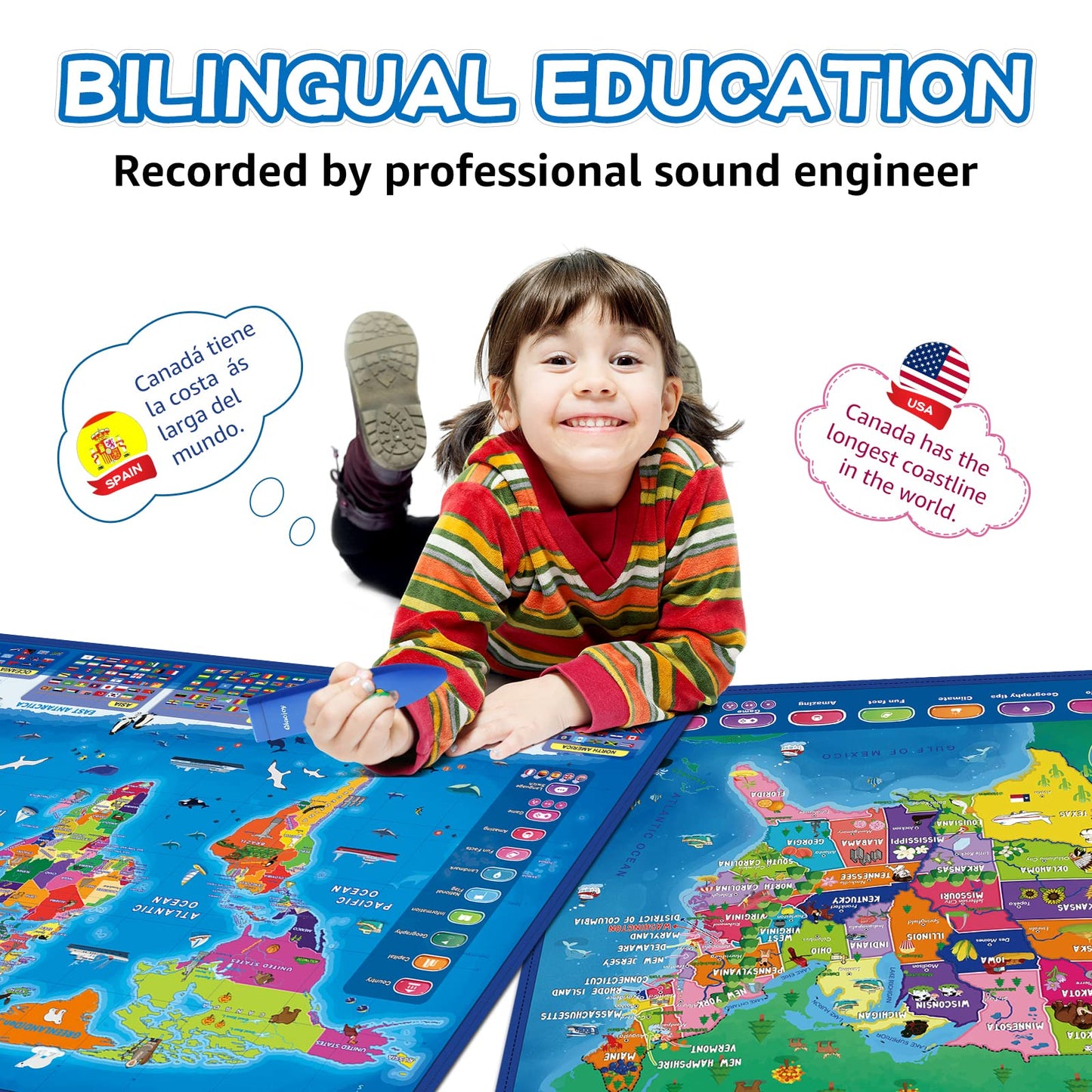
Qiaojoy Bilingual Interactive For Kids Talking Usa Map World Map For Kids Learning, Geography Toys Games Educational Electronic Map Personalized Gift/Toys For 4 5 6 7 8 9 10 Year Old Girls/Boys


Frequently Asked Questions
- Q: What are the dimensions of the Qiaojoy Bilingual Interactive Map? A: The dimensions are thirteen point five eight inches in length, eight point three nine inches in width, and one point seven seven inches in height.
- Q: What material is the Qiaojoy Interactive Map made of? A: The map is made of plastic, ensuring durability and safety for kids.
- Q: How many interactive features does the USA Map have? A: The USA Map features ten interactive elements that provide over two thousand fun geography facts.
- Q: How do kids interact with the map? A: Kids can use a stylus to touch different parts of the map, activating sounds and facts about geography.
- Q: Is the Qiaojoy Interactive Map suitable for all ages? A: Yes, it is designed for children aged four to ten years old, making it ideal for young learners.
- Q: Can the map be used to learn both English and Spanish? A: Yes, the map supports bilingual learning, helping children study in both English and Spanish.
- Q: How should I clean the Qiaojoy Interactive Map? A: To clean, use a damp cloth and mild soap; avoid submerging the map in water to maintain its electronic components.
- Q: Are there any safety concerns with this educational toy? A: No, the Qiaojoy Interactive Map is safe for children, having received multiple awards for its educational value.
- Q: How should I store the map when not in use? A: Store the map in a dry place, preferably in its original packaging, to protect it from damage.
- Q: What awards has the Qiaojoy Interactive Map received? A: It has won several awards, including the Seal of Approval from The National Parenting Center and the Tillywig Brain Child Award.
- Q: What kind of quizzes can kids play with the map? A: The map features three levels of quiz games designed to engage kids while they learn geography.
- Q: What countries can kids learn about using the map? A: Children can explore facts about all one hundred ninety-five countries around the world.
- Q: Does the map come with any additional accessories? A: Yes, it includes a stylus for interactive play and supports a recording function for kids to create their own stories.
- Q: Is this interactive map a good gift for kids? A: Absolutely, it is a popular choice for Christmas gifts and educational presents for children.
- Q: What kind of geographical information does the map provide? A: The map provides information about countries, including flags, capitals, populations, languages, and more.